TC Watch / 熱帶氣旋 > Latest TC Info 最新熱帶氣旋資訊 [Refresh 更新]

Quick links 快速連結: Current Storm Info 實時氣旋資料 Past Storm Info 過去氣旋資料
HKO Storm Info 天文台之熱帶氣旋資訊 TC Archive 熱帶氣旋資料庫
Official TC Track Info 官方熱帶氣旋路徑資料 Selected TC Review 重要熱帶氣旋回顧
Tracks from Non-Governmental Agencies 民辦網站預測路徑圖 TC Finder 熱帶氣旋尋找工具
Active Tropical Cyclone(s) 正活躍之熱帶氣旋

Current TC Map 即時氣旋資訊Current TC information

Tropical Cyclone Report 熱帶氣旋報告 [Our partner site's TC report 按此看友站的氣旋報告]

1. 01W (LINGLING 玲玲)

Name of System 系統名稱

TD LINGLING 熱帶低氣壓 玲玲


JTWC No. / Int'l No. JTWC 編號 / 國際編號 01W / 1401
Bulletin Number 發佈編號 #2 FINAL BULLETIN 最後發佈
Time of Report 報告時間

2014/01/19, 15:15 HKT (07:15 UTC)

Time of Observation 觀測時間 2014/01/19, 14:00 HKT (06:00 UTC)
Position 位置 7.3°N, 127.9°E
Maximum Gust 最高陣風 35 knots 節 (65 km/h 公里每小時)
1-min. Average Wind Speed 1分鐘平均風速 30 knots 節 (55 km/h 公里每小時)
10-min. Average Wind Speed 10分鐘平均風速 25 knots 節 (45 km/h 公里每小時)
Pressure 氣壓 1004 hPa 百帕斯卡
Past 6-hr Movement 過去6小時移向和移速 S 南 (169°) at 5 knots 節 (9 km/h 公里每小時)
Area(s) affected 受影響地區 Southeastern Philippines 菲律賓東南部

Forecast Track 預測路徑圖

Forecast Positions 預測位置資料

Tau
時間差
HK Time
香港時間
Lat.
緯度
Long.
經度
Movement
移動速度和方向
1-min Average Strength
一分鐘平均強度
t+001/19 (Sun) 14:007.3°N127.9°ES 南 (189°) 6 km/h30 kt (56 km/h)TD 熱帶低氣壓
t+1201/20 (Mon) 02:006.7°N127.8°ESW 西南 (236°) 7 km/h25 kt (46 km/h)TD 熱帶低氣壓
t+2401/20 (Mon) 14:006.3°N127.2°EN/A20 kt (37 km/h)LPA 低壓區
Overview 總覽

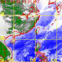
LINGLING has weakened into a tropical depression. At 2 pm, LINGLING was centred about 1110 km (600 NM) SE of Manila.

玲玲已減弱為熱帶低氣壓。在下午 2 時,玲玲集結在馬尼拉東南約 1110 公里 (600 海里)。

TC Naming 氣旋命名

LINGLING is the 46th name in the tropical cyclone name list. It was contributed by Hong Kong, and is a common pet name for young girls. This name was used in 2001 and 2007.

玲玲為熱帶氣旋名稱列表中第 46 個名字,由香港提供,為一個頗為普遍的少女暱稱。此名曾於 2001 及 2007 年使用。

Movement Analysis 路徑分析

LINGLING is still drifting slowly. It is expected to move S to SW in the next 24 hours.

玲玲仍然移動緩慢。預料玲玲將於未來 24 小時向南至西南移動。

Intensity Analysis 強度分析

Current T-number 現時的 T 號碼: T1.5/2.0/W0.5/24 HRS

LINGLING's structure has deteriorated in the past 12 hours. The storm is expected to weaken in high vertical wind shear environment and dissipate in the vicinity of Mindanao tomorrow.

玲玲的組織於過去 12 小時轉差。在高垂直風切變環境下,玲玲將繼續減弱,並預料於明天在棉蘭老島附近消散。

Effects on Hong Kong 對香港的影響

No threat to Hong Kong is expected within the next 72 hours.

預料玲玲於未來的 72 小時將不會對香港構成影響。

Next Update 下次更新

This is the final bulletin on LINGLING.

這是本站對玲玲的最後一次發佈。

Other Images 其他圖像
JTWC Track 聯合颱風警報中心路徑圖
JMA Track 日本氣象廳路徑圖
HKO Satellite 香港天文台衛星圖
HKO Track 香港天文台路徑圖
Probabilities of TC Signals from HKO 香港天文台發出 / 取消熱帶氣旋警告信號的機率

N/A 不適用


Past Bulletins (click on the bulletin no. for the contents) 過往報告 (請按發佈編號顯示內容)

+01W (LINGLING 玲玲) Bulletin 發佈 #1 (2014/01/18, 16:30 HKT)

Name of System 系統名稱

TS LINGLING 熱帶風暴 玲玲


JTWC No. / Int'l No. JTWC 編號 / 國際編號 01W / 1401
Bulletin Number 發佈編號 #1
Time of Report 報告時間

2014/01/18, 16:30 HKT (08:30 UTC)

Time of Observation 觀測時間 2014/01/18, 14:00 HKT (06:00 UTC)
Position 位置 9.1°N, 127.8°E
Maximum Gust 最高陣風 45 knots 節 (85 km/h 公里每小時)
1-min. Average Wind Speed 1分鐘平均風速 35 knots 節 (65 km/h 公里每小時)
10-min. Average Wind Speed 10分鐘平均風速 30 knots 節 (55 km/h 公里每小時)
Pressure 氣壓 1002 hPa 百帕斯卡
Past 6-hr Movement 過去6小時移向和移速 SSE 東南偏南 (158°) at 5 knots 節 (10 km/h 公里每小時)
Area(s) affected 受影響地區 Southeastern Philippines 菲律賓東南部

Forecast Track 預測路徑圖

Forecast Positions 預測位置資料

Tau
時間差
HK Time
香港時間
Lat.
緯度
Long.
經度
Movement
移動速度和方向
1-min Average Strength
一分鐘平均強度
t+0 01/18 (Sat) 14:00 9.1°N 127.8°E SW 西南 (217°) 5 km/h 35 kt (65 km/h) TS 熱帶風暴
t+12 01/19 (Sun) 02:00 8.7°N 127.5°E WSW 西南偏西 (240°) 7 km/h 35 kt (65 km/h) TS 熱帶風暴
t+24 01/19 (Sun) 14:00 8.3°N 126.8°E WSW 西南偏西 (243°) 8 km/h 35 kt (65 km/h) TS 熱帶風暴
t+36 01/20 (Mon) 02:00 7.9°N 126.0°E N/A 25 kt (46 km/h) TD 熱帶低氣壓
Overview 總覽

Tropical disturbance 91W intensified into the tropical cyclone 01W today. It reached tropical storm strength and was named LINGLING by the JMA. At 2 pm, LINGLING was centred about 960 km (520 NM) SE of Manila.

熱帶擾動 91W 今天增強為熱帶氣旋 01W。01W 達到熱帶風暴強度,被日本氣象廳命名為玲玲。在下午 2 時,玲玲集結在馬尼拉東南約 960 公里 (520 海里)。

TC Naming 氣旋命名

LINGLING is the 46th name in the tropical cyclone name list. It was contributed by Hong Kong, and is a common pet name for young girls. This name was used in 2001 and 2007.

玲玲為熱帶氣旋名稱列表中第 46 個名字,由香港提供,為一個頗為普遍的少女暱稱。此名曾於 2001 及 2007 年使用。

Movement Analysis 路徑分析

LINGLING is in a weak steering environment and has been moving erratically in the past 24 hours. It is expected to drift slowly towards SW in general under weak low-level northeasterly winds towards Mindanao.

玲玲處於弱流場環境,於過去 24 小時移動不規則。預料玲玲將受微弱低層東北風影響,大致向西南移動,趨向棉蘭老島。

Intensity Analysis 強度分析

Current T-number 現時的 T 號碼: T2.0/2.0/INT OBS

LINGLING has a well-defined low-level circulation centre but the most intense convections are displaced to the northwestern quadrant. The storm is not expected to intensify much due to moderate to high vertical wind shear and proximity to land, and should weaken once it makes landfall.

玲玲擁有明顯低層環流中心,但深層對流向西北方切離。在中等至偏高垂直風切變及靠近陸地的環境下,預料玲玲不會大幅增強,並會於登陸後減弱。

Effects on Hong Kong 對香港的影響

No threat to Hong Kong is expected within the next 72 hours.

預料玲玲於未來的 72 小時將不會對香港構成影響。

Next Update 下次更新

2014/01/19 (Sun 日), afternoon 下午 (or earlier 或更早)

Other Images 其他圖像
JTWC Track 聯合颱風警報中心路徑圖
JMA Track 日本氣象廳路徑圖
HKO Satellite 香港天文台衛星圖
HKO Track 香港天文台路徑圖
Probabilities of TC Signals from HKO 香港天文台發出 / 取消熱帶氣旋警告信號的機率

N/A 不適用


Track Data from HKWW 本站之路徑資料

YYMMDDZZ Lat Long Wind
14011718 093N1275E 025
14011800 096N1276E 035
14011806 091N1278E 035
14011812 089N1276E 035
14011818 086N1276E 035
14011900 078N1278E 030
14011906 073N1279E 030