RAMMASUN has made landfall in Guangxi and is now crossing northern Vietnam. At 8 pm, RAMMASUN was centred about 200 km (110 NM) N of Hanoi. The #1 Standby Signal was cancelled at 3:40 am today.
RAMMASUN is the 54th name in the tropical cyclone name list. It was contributed by Thailand, and is the god of thunder. This name was used in 2002 and 2008.
RAMMASUN intensified into a super typhoon before making landfall at northeastern Hainan this afternoon. It has since then weakened as it crosses Leizhou Peninsula. At 8 pm, RAMMASUN was centred about 460 km (250 NM) WSW of Hong Kong. The #1 Standby Signal was issued at 7:40 pm, replacing the #3 Signal.
RAMMASUN is the 54th name in the tropical cyclone name list. It was contributed by Thailand, and is the god of thunder. This name was used in 2002 and 2008.
RAMMASUN is expected to move WNW along the southwestern periphery of the subtropical ridge, crossing the Gulf of Tonkin and making a final landfall near the China-Vietnam border.
威馬遜將沿副熱帶高壓脊西南部向西北偏西移動,橫過北部灣並於中越邊界一帶作最後登陸。
Intensity
Analysis 強度分析
Current T-number 現時的 T 號碼: T6.0/7.0/D1.0/24 HRS W1.0/06 HRS
Sustained wind speeds of over 200 km/h were reported in northeastern Hainan when RAMMASUN made landfall there this afternoon. As land interaction kicks in, RAMMASUN is expected to lose strength gradually, degenerating into an area of low pressure two to three days later.
Winds eased tonight, but strong winds are still blowing in offshore areas occasionally. As RAMMASUN moves west, winds should subside overnight, while occasional heavy showers are still expected early tomorrow.
雖然風速漸降,但離岸地區仍間中吹強風。隨著威馬遜西移,風勢應於晚間減弱,但明早仍間中會有大驟雨。
Next Update
下次更新
2014/07/19 (Sat 六), nighttime 晚間 (or earlier 或更早)
Other Images
其他圖像
JTWC Track 聯合颱風警報中心路徑圖
JMA Track 日本氣象廳路徑圖
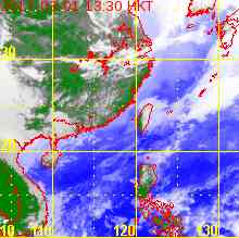
HKO Satellite 香港天文台衛星圖
HKO Track 香港天文台路徑圖
Probabilities
of TC Signals from HKO 香港天文台發出 / 取消熱帶氣旋警告信號的機率
Signal 信號
t+12
t+24
t+36
t+48
t+60
t+72
Standby 戒備 #1 (取消 Cnl)
Very High 極高
Very High 極高
Very High 極高
Very High 極高
Very High 極高
Very High 極高
Strong Wind 強風 #3
Gale/Storm 烈或暴風 #8
G/S Incr. 烈或暴風增強 #9
Hurricane 颶風 #10
Notes 註:
1) For issuance, "Signal" column represents having issued that signal or above. 有關發出機率,首欄指已發出該信號或更高信號。
2) "Low" = Probability from 5 to 20 per cent; "Medium" = 20 to 50%; "High" = 50 to 80%; "V High" = 80% or above.
"低" = 5% - 20% 的機率; "中等" = 20 - 50%; "高" = 50 - 80%; "極高" = 80% 或以上。
RAMMASUN is moving NW and has started to re-intensify. At 8 pm, RAMMASUN was centred about 530 km (290 NM) S of Hong Kong. The #1 Standby Signal and #3 Strong Wind Signal were issued at 11:40 pm (yesterday) and 4:15 pm respectively.
RAMMASUN is the 54th name in the tropical cyclone name list. It was contributed by Thailand, and is the god of thunder. This name was used in 2002 and 2008.
RAMMASUN is expected to move NW turning to WNW along the southwestern periphery of the subtropical ridge, making landfall at Hainan or western Guangdong tomorrow. A final landfall is expected near the China-Vietnam border.
RAMMASUN's eye reappeared and the storm is deepening. It is expected to reach category 3 or even 4 before making landfall in southern China. Thereafter, a weakening trend follows as land interaction kicks in.
Strong winds and heavy showers are now affecting Hong Kong. As RAMMASUN gets closer, winds will get stronger tonight, with a chance of reaching gale force at offshore areas and on high grounds. Wind direction will veer from E to SE tomorrow. Showers are still expected tomorrow and on Saturday.
RAMMASUN is the 54th name in the tropical cyclone name list. It was contributed by Thailand, and is the god of thunder. This name was used in 2002 and 2008.
There is some erratic movement as RAMMASUN's convections re-organize after crossing the Philippines. The storm is expected to move WNW along the southwestern periphery of the subtropical ridge towards Hainan Island.
RAMMASUN's northern semicircle was somewhat destroyed after passing the Philippines, but a tight banding centre is evident. Shear is at a moderate level, but sea temperatures are very warm and should sustain development in the next 36 hours. RAMMASUN will weaken as it crosses Hainan and enters the Gulf of Tonkin.
The weather will deteriorate tomorrow night, with winds strengthening from the E/NE and rain becoming more frequent. Winds will veer from E to SE on Friday, reaching strong force. Winds will gradually ease on Saturday, but there will still be showers occasionally. Recent forecasts have been consistent in putting RAMMASUN's closest approach to Hong Kong at around or beyond 400 km; at such distance, stronger winds seem unlikely.
RAMMASUN is the 54th name in the tropical cyclone name list. It was contributed by Thailand, and is the god of thunder. This name was used in 2002 and 2008.
RAMMASUN has started to move WNW. The subtropical ridge currently steering the storm is expected re-orientate in a way that places RAMMASUN in its southwestern periphery, allowing a persistent track to the WNW as RAMMASUN crosses the South China Sea.
RAMMASUN developed a clear eye just before landfall. Due to land interaction, RAMMASUN is expected to weaken in the next 24 hours while still retaining typhoon intensity. The storm should be able to re-intensify in northern South China Sea as conditions are favourable there.
As RAMMASUN nears northern South China Sea, local weather is expected to deteriorate on Thursday, with winds strengthening from the E/NE and rain becoming more frequent. Winds will veer from E to SE on Friday, reaching strong force. Recent forecasts have been consistent in putting RAMMASUN's closest approach to Hong Kong at around 400 km; at such distance, stronger winds seem unlikely.
RAMMASUN is the 54th name in the tropical cyclone name list. It was contributed by Thailand, and is the god of thunder. This name was used in 2002 and 2008.
The subtropical ridge is seen protruding southwards east of the storm, and a mid-latitude trough in central China is propagating eastwards. The western edge of the ridge is expected to weaken, and the ridge should re-orientate in a way that places RAMMASUN in its southwestern periphery, allowing a change of direction to WNW.
Upper-level divergence improved considerably today, allowing RAMMASUN to ventilate. This has contributed to its fast-paced development over the last 12 hours. The storm is expected to intensify further before making landfall, while crossing the Philippines should result in substantial weakening. Conditions in South China Sea are favourable for re-intensification.
As RAMMASUN nears northern South China Sea, local weather is expected to deteriorate on Thursday, with winds strengthening from the E/NE and rain becoming more frequent. According to the present forecast, the weather in Hong Kong will be the worst on Friday.
RAMMASUN is the 54th name in the tropical cyclone name list. It was contributed by Thailand, and is the god of thunder. This name was used in 2002 and 2008.
The subtropical ridge remains strong and is anchored N of RAMMASUN. Under its influence, RAMMASUN is expected to move W in the next 36 hours. Thereafter, the ridge is expected to weaken slightly, which places RAMMASUN in its southwestern periphery. A WNW track is thus predicted.
Owing to weak diffluence channels within the strong subtropical ridge, RAMMASUN failed to organize in the past 24 hours. Stronger shear also saw RAMMASUN's convections sheared to the west. This situation is expected to persist in the next 12 to 24 hours, severely limiting RAMMASUN's development. Quicker intensification is expected just prior to the storm's landfall in the Philippines as shear decreases again and inhibition of divergence lessens. The storm will almost certainly weaken as it crosses the island country, but is expected to regain strength in the warm South China Sea.
RAMMASUN is the 54th name in the tropical cyclone name list. It was contributed by Thailand, and is the god of thunder. This name was used in 2002 and 2008.
The subtropical ridge remains strong and is anchored NW of RAMMASUN. Under its influence, RAMMASUN is expected to move W in the next 48 hours, with the possibility of a southward dip in the early taus. Thereafter, the ridge is expected to weaken, which places RAMMASUN in its southwestern periphery. A WNW track is thus predicted.
RAMMASUN weakened last night but its structure improved considerably today. The storm is expected to intensify gradually in warm seas with low shear, but the rate of intensification may be slower in the early taus as the storm tries to organize itself.
The subtropical ridge is situated north of 09W. Under its influence, 09W should move W or WNW in the next 72 hours. The ridge is expected to weaken later on, which may result in a more poleward track.
 Active Tropical Cyclone(s) 正活躍之熱帶氣旋