TC Watch / Ľö±a®đ±Ű
> Latest TC Info łĚ·sĽö±a®đ±Ű¸ę°T [Refresh §ó·s ]
Current
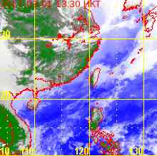
TC Map §Y®É®đ±Ű¸ę°T
1. 19W (PABUK ©¬Ą¬)
Name of System ¨t˛Î¦WşŮ
TY (CAT. 1) PABUK ¤@ŻĹ»ä· ©¬Ą¬
JTWC No. / Int'l No. JTWC
˝s¸ą / °ę»Ú˝s¸ą
19W / 1320
Bulletin Number µo§G˝s¸ą
#7 FINAL BULLETIN łĚ«áµo§G
Time of
Report łř§i®É¶ˇ
2013/09/27, 05:45 HKT (09/26 21:45 UTC)
Time of
Observation Ć[´ú®É¶ˇ
2013/09/27,
02:00 HKT (09/26 18:00 UTC)
Position ¦ě¸m
37.1°N, 149.9°E
Maximum Gust łĚ°Ş°}·
80 knots ¸` (150 km/h ¤˝¨˝¨C¤p®É)
1-min. Average Wind Speed 1¤ŔÄÁĄ§ˇ·łt
65 knots ¸` (120 km/h ¤˝¨˝¨C¤p®É)
10-min. Average Wind Speed 10¤ŔÄÁĄ§ˇ·łt
60 knots ¸` (110 km/h ¤˝¨˝¨C¤p®É)
Pressure ®đŔŁ
975 hPa ¦Ę©¬´µĄd
Past 6-hr Movement ąLĄh6¤p®É˛ľ¦V©M˛ľłt
NE ŞFĄ_ (047°) at 30 knots ¸` (55 km/h ¤˝¨˝¨C¤p®É)
Area(s) affected ¨üĽvĹT¦a°Ď
N/A ¤ŁľAĄÎ
Forecast
Track ąw´ú¸ô®|ąĎ
Forecast
Positions ąw´ú¦ě¸m¸ę®Ć
Tau HK Time Lat. Long. Movement 1-min Average Strength t+0 09/27 (Fri) 02:00 37.1°N 149.9°E NE ŞFĄ_ (046°) 64 km/h 65 kt (120 km/h) TY (Cat. 1) ¤@ŻĹ»ä· t+12 09/27 (Fri) 14:00 41.7°N 156.5°E N/A 60 kt (111 km/h) Ext Cyclone ·Ĺ±a®đ±Ű
Overview
Á`Äý
PABUK is transforming into an extratropical cyclone. At 2 am, PABUK was centred about 920 km (500 NM) ENE of Tokyo.
©¬Ą¬ĄżÂŕ¤Ć¬°·Ĺ±a®đ±ŰˇC¦b¤W¤Č 2 ®ÉˇA©¬Ą¬¶°µ˛¦bŞF¨ĘŞFĄ_°ľŞF¬ů 920 ¤˝¨˝ (500 ®ü¨˝)ˇC
TC
Naming ®đ±Ű©R¦W
PABUK is the 34th name in the tropical cyclone name list. It was contributed by Laos, and is a big fresh water fish. This name was used in 2001 and 2007, with the latter occurrence necessitating the #8 Gale or Storm Signal.
©¬Ą¬¬°Ľö±a®đ±Ű¦WşŮ¦CŞí¤¤˛Ä 34 Ó¦W¦rˇAĄŃ¦Ńľâ´Ł¨ŃˇA¬O¤@şŘ¤j§Î˛H¤ôł˝ ˇC¦ą¦W´ż©ó 2001 ¤Î 2007 ¦~¨ĎĄÎˇA«áŞĚ´żĄO¤Ń¤ĺĄxµoĄX¤K¸ąŻP·©ÎĽÉ·«H¸ąˇC
Movement
Analysis ¸ô®|¤ŔŞR
PABUK is expected to accelerate NE along the NW periphery of the subtropical ridge.
©¬Ą¬±NŞu°ĆĽö±a°ŞŔŁŻá¦čĄ_łˇ¦VŞFĄ_Ą[łt˛ľ°ĘˇC
Intensity
Analysis ±j«×¤ŔŞR
Current T-number: T3.5/4.0/W1.0/24 HRS
˛{®ÉŞş T ¸ą˝X: T3.5/4.0/W1.0/24 HRS
Effects on
Hong Kong ąď»´äŞşĽvĹT
No threat to Hong Kong is expected within the next 72 hours.
ąw®Ć©¬Ą¬©óĄĽ¨ÓŞş 72 ¤p®É±N¤Ł·|ąď»´äşc¦¨Ąô¦óĽvĹTˇC
Next Update
¤U¦¸§ó·s
This is the final bulletin on PABUK.
ło¬OĄ»Ż¸ąď©¬Ą¬ŞşłĚ«á¤@¦¸µo§GˇC
Other Images
¨äĄLąĎął
JTWC Track Áp¦X»ä·Äµłř¤¤¤ß¸ô®|ąĎ
JMA Track ¤éĄ»®đ¶HĆU¸ô®|ąĎ
HKO Satellite »´ä¤Ń¤ĺĄx˝Ă¬PąĎ
HKO Track »´ä¤Ń¤ĺĄx¸ô®|ąĎ
Probabilities
of TC Signals from HKO »´ä¤Ń¤ĺĄxµoĄX / ¨ú®řĽö±a®đ±Űĵ§i«H¸ąŞşľ÷˛v
N/A ¤ŁľAĄÎ
Name of System ¨t˛Î¦WşŮ
TY (CAT. 1) PABUK ¤@ŻĹ»ä· ©¬Ą¬
JTWC No. / Int'l No. JTWC
˝s¸ą / °ę»Ú˝s¸ą
19W / 1320
Bulletin Number µo§G˝s¸ą
#6
Time of
Report łř§i®É¶ˇ
2013/09/26, 12:00 HKT (04:00 UTC)
Time of
Observation Ć[´ú®É¶ˇ
2013/09/26,
08:00 HKT (00:00 UTC)
Position ¦ě¸m
32.2°N, 143.5°E
Maximum Gust łĚ°Ş°}·
95 knots ¸` (175 km/h ¤˝¨˝¨C¤p®É)
1-min. Average Wind Speed 1¤ŔÄÁĄ§ˇ·łt
80 knots ¸` (150 km/h ¤˝¨˝¨C¤p®É)
10-min. Average Wind Speed 10¤ŔÄÁĄ§ˇ·łt
75 knots ¸` (140 km/h ¤˝¨˝¨C¤p®É)
Pressure ®đŔŁ
960 hPa ¦Ę©¬´µĄd
Past 6-hr Movement ąLĄh6¤p®É˛ľ¦V©M˛ľłt
NE ŞFĄ_ (053°) at 20 knots ¸` (37 km/h ¤˝¨˝¨C¤p®É)
Area(s) affected ¨üĽvĹT¦a°Ď
N/A ¤ŁľAĄÎ
Forecast
Track ąw´ú¸ô®|ąĎ
Forecast
Positions ąw´ú¦ě¸m¸ę®Ć
Tau
HK Time
Lat.
Long.
Movement
1-min Average Strength
t+0
09/26 (Thu) 08:00
32.2°N
143.5°E
NE ŞFĄ_ (043°) 45 km/h
80 kt (148 km/h)
TY (Cat. 1) ¤@ŻĹ»ä·
t+12
09/26 (Thu) 20:00
35.7°N
147.6°E
NE ŞFĄ_ (040°) 50 km/h
70 kt (130 km/h)
TY (Cat. 1) ¤@ŻĹ»ä·
t+24
09/27 (Fri) 08:00
39.8°N
152.1°E
NE ŞFĄ_ (038°) 64 km/h
60 kt (111 km/h)
STS ±jŻPĽö±a·ĽÉ
t+36
09/27 (Fri) 20:00
45.1°N
158.1°E
N/A
50 kt (93 km/h)
Ext Cyclone ·Ĺ±a®đ±Ű
Overview
Á`Äý
PABUK has turned northeast while maintaining typhoon intensity. At 8 am, PABUK was centred about 520 km (280 NM) SE of Tokyo.
©¬Ą¬Âŕ¦VŞFĄ_˛ľ°ĘˇAĄB«O«ů»ä·±j«×ˇC¦b¤W¤Č 8 ®ÉˇA©¬Ą¬¶°µ˛¦bŞF¨ĘŞF«n¬ů 520 ¤˝¨˝ (280 ®ü¨˝)ˇC
TC
Naming ®đ±Ű©R¦W
PABUK is the 34th name in the tropical cyclone name list. It was contributed by Laos, and is a big fresh water fish. This name was used in 2001 and 2007, with the latter occurrence necessitating the #8 Gale or Storm Signal.
©¬Ą¬¬°Ľö±a®đ±Ű¦WşŮ¦CŞí¤¤˛Ä 34 Ó¦W¦rˇAĄŃ¦Ńľâ´Ł¨ŃˇA¬O¤@şŘ¤j§Î˛H¤ôł˝ ˇC¦ą¦W´ż©ó 2001 ¤Î 2007 ¦~¨ĎĄÎˇA«áŞĚ´żĄO¤Ń¤ĺĄxµoĄX¤K¸ąŻP·©ÎĽÉ·«H¸ąˇC
Movement
Analysis ¸ô®|¤ŔŞR
PABUK is expected to accelerate NE along the NW periphery of the subtropical ridge.
©¬Ą¬±NŞu°ĆĽö±a°ŞŔŁŻá¦čĄ_łˇ¦VŞFĄ_Ą[łt˛ľ°ĘˇC
Intensity
Analysis ±j«×¤ŔŞR
Current T-number: T4.5/4.5/S0.0/24 HRS
˛{®ÉŞş T ¸ą˝X: T4.5/4.5/S0.0/24 HRS
Effects on
Hong Kong ąď»´äŞşĽvĹT
No threat to Hong Kong is expected within the next 72 hours.
ąw®Ć©¬Ą¬©óĄĽ¨ÓŞş 72 ¤p®É±N¤Ł·|ąď»´äşc¦¨Ąô¦óĽvĹTˇC
Next Update
¤U¦¸§ó·s
2013/09/27 (Fri ¤), afternoon ¤U¤Č (or earlier ©Î§ó¦)
Other Images
¨äĄLąĎął
JTWC Track Áp¦X»ä·Äµłř¤¤¤ß¸ô®|ąĎ
JMA Track ¤éĄ»®đ¶HĆU¸ô®|ąĎ
HKO Satellite »´ä¤Ń¤ĺĄx˝Ă¬PąĎ
HKO Track »´ä¤Ń¤ĺĄx¸ô®|ąĎ
Probabilities
of TC Signals from HKO »´ä¤Ń¤ĺĄxµoĄX / ¨ú®řĽö±a®đ±Űĵ§i«H¸ąŞşľ÷˛v
N/A ¤ŁľAĄÎ
Name of System ¨t˛Î¦WşŮ
TY (CAT. 1) PABUK ¤@ŻĹ»ä· ©¬Ą¬
JTWC No. / Int'l No. JTWC
˝s¸ą / °ę»Ú˝s¸ą
19W / 1320
Bulletin Number µo§G˝s¸ą
#5
Time of
Report łř§i®É¶ˇ
2013/09/25, 13:00 HKT (05:00 UTC)
Time of
Observation Ć[´ú®É¶ˇ
2013/09/25,
08:00 HKT (00:00 UTC)
Position ¦ě¸m
28.4°N, 138.8°E
Maximum Gust łĚ°Ş°}·
90 knots ¸` (165 km/h ¤˝¨˝¨C¤p®É)
1-min. Average Wind Speed 1¤ŔÄÁĄ§ˇ·łt
75 knots ¸` (140 km/h ¤˝¨˝¨C¤p®É)
10-min. Average Wind Speed 10¤ŔÄÁĄ§ˇ·łt
70 knots ¸` (130 km/h ¤˝¨˝¨C¤p®É)
Pressure ®đŔŁ
965 hPa ¦Ę©¬´µĄd
Past 6-hr Movement ąLĄh6¤p®É˛ľ¦V©M˛ľłt
N Ą_ (006°) at 9 knots ¸` (17 km/h ¤˝¨˝¨C¤p®É)
Area(s) affected ¨üĽvĹT¦a°Ď
Seas near Iwo Jima ˛¸ÁD®q¤@±a®ü°ě
Forecast
Track ąw´ú¸ô®|ąĎ
Forecast
Positions ąw´ú¦ě¸m¸ę®Ć
Tau
HK Time
Lat.
Long.
Movement
1-min Average Strength
t+0
09/25 (Wed) 08:00
28.4°N
138.8°E
NNE ŞFĄ_°ľĄ_ (033°) 22 km/h
75 kt (139 km/h)
TY (Cat. 1) ¤@ŻĹ»ä·
t+12
09/25 (Wed) 20:00
30.4°N
140.3°E
NE ŞFĄ_ (040°) 32 km/h
80 kt (148 km/h)
TY (Cat. 1) ¤@ŻĹ»ä·
t+24
09/26 (Thu) 08:00
33.0°N
142.9°E
NE ŞFĄ_ (042°) 38 km/h
70 kt (130 km/h)
TY (Cat. 1) ¤@ŻĹ»ä·
t+36
09/26 (Thu) 20:00
36.0°N
146.3°E
NE ŞFĄ_ (040°) 48 km/h
60 kt (111 km/h)
STS ±jŻPĽö±a·ĽÉ
t+48
09/27 (Fri) 08:00
39.9°N
150.7°E
N/A
50 kt (93 km/h)
Ext Cyclone ·Ĺ±a®đ±Ű
Overview
Á`Äý
PABUK is now recurving. At 8 am, PABUK was centred about 810 km (440 NM) S of Tokyo.
©¬Ą¬˛{ĄżÂŕ¦VˇC¦b¤W¤Č 8 ®ÉˇA©¬Ą¬¶°µ˛¦bŞF¨ĘĄH«n¬ů 810 ¤˝¨˝ (440 ®ü¨˝)ˇC
TC
Naming ®đ±Ű©R¦W
PABUK is the 34th name in the tropical cyclone name list. It was contributed by Laos, and is a big fresh water fish. This name was used in 2001 and 2007, with the latter occurrence necessitating the #8 Gale or Storm Signal.
©¬Ą¬¬°Ľö±a®đ±Ű¦WşŮ¦CŞí¤¤˛Ä 34 Ó¦W¦rˇAĄŃ¦Ńľâ´Ł¨ŃˇA¬O¤@şŘ¤j§Î˛H¤ôł˝ ˇC¦ą¦W´ż©ó 2001 ¤Î 2007 ¦~¨ĎĄÎˇA«áŞĚ´żĄO¤Ń¤ĺĄxµoĄX¤K¸ąŻP·©ÎĽÉ·«H¸ąˇC
Movement
Analysis ¸ô®|¤ŔŞR
PABUK is expected to accelerate NE along the NW periphery of the subtropical ridge.
©¬Ą¬±NŞu°ĆĽö±a°ŞŔŁŻá¦čĄ_łˇ¦VŞFĄ_Ą[łt˛ľ°ĘˇC
Intensity
Analysis ±j«×¤ŔŞR
Current T-number: T4.5/4.5/D0.5/24 HRS
˛{®ÉŞş T ¸ą˝X: T4.5/4.5/D0.5/24 HRS
Effects on
Hong Kong ąď»´äŞşĽvĹT
No threat to Hong Kong is expected within the next 72 hours.
ąw®Ć©¬Ą¬©óĄĽ¨ÓŞş 72 ¤p®É±N¤Ł·|ąď»´äşc¦¨Ąô¦óĽvĹTˇC
Next Update
¤U¦¸§ó·s
2013/09/26 (Thu Ą|), afternoon ¤U¤Č (or earlier ©Î§ó¦)
Other Images
¨äĄLąĎął
JTWC Track Áp¦X»ä·Äµłř¤¤¤ß¸ô®|ąĎ
JMA Track ¤éĄ»®đ¶HĆU¸ô®|ąĎ
HKO Satellite »´ä¤Ń¤ĺĄx˝Ă¬PąĎ
HKO Track »´ä¤Ń¤ĺĄx¸ô®|ąĎ
Probabilities
of TC Signals from HKO »´ä¤Ń¤ĺĄxµoĄX / ¨ú®řĽö±a®đ±Űĵ§i«H¸ąŞşľ÷˛v
N/A ¤ŁľAĄÎ
Name of System ¨t˛Î¦WşŮ
TY (CAT. 1) PABUK ¤@ŻĹ»ä· ©¬Ą¬
JTWC No. / Int'l No. JTWC
˝s¸ą / °ę»Ú˝s¸ą
19W / 1320
Bulletin Number µo§G˝s¸ą
#4
Time of
Report łř§i®É¶ˇ
2013/09/24, 12:15 HKT (04:15 UTC)
Time of
Observation Ć[´ú®É¶ˇ
2013/09/24,
08:00 HKT (00:00 UTC)
Position ¦ě¸m
25.7°N, 139.8°E
Maximum Gust łĚ°Ş°}·
75 knots ¸` (140 km/h ¤˝¨˝¨C¤p®É)
1-min. Average Wind Speed 1¤ŔÄÁĄ§ˇ·łt
65 knots ¸` (120 km/h ¤˝¨˝¨C¤p®É)
10-min. Average Wind Speed 10¤ŔÄÁĄ§ˇ·łt
60 knots ¸` (110 km/h ¤˝¨˝¨C¤p®É)
Pressure ®đŔŁ
975 hPa ¦Ę©¬´µĄd
Past 6-hr Movement ąLĄh6¤p®É˛ľ¦V©M˛ľłt
NW ¦čĄ_ (312°) at 6 knots ¸` (11 km/h ¤˝¨˝¨C¤p®É)
Area(s) affected ¨üĽvĹT¦a°Ď
Iwo Jima ˛¸ÁD®q
Forecast
Track ąw´ú¸ô®|ąĎ
Forecast
Positions ąw´ú¦ě¸m¸ę®Ć
Tau
HK Time
Lat.
Long.
Movement
1-min Average Strength
t+0
09/24 (Tue) 08:00
25.7°N
139.8°E
NW ¦čĄ_ (325°) 11 km/h
65 kt (120 km/h)
TY (Cat. 1) ¤@ŻĹ»ä·
t+12
09/24 (Tue) 20:00
26.7°N
139.0°E
NNW ¦čĄ_°ľĄ_ (345°) 12 km/h
65 kt (120 km/h)
TY (Cat. 1) ¤@ŻĹ»ä·
t+24
09/25 (Wed) 08:00
28.0°N
138.6°E
NNE ŞFĄ_°ľĄ_ (027°) 20 km/h
70 kt (130 km/h)
TY (Cat. 1) ¤@ŻĹ»ä·
t+36
09/25 (Wed) 20:00
29.9°N
139.7°E
NE ŞFĄ_ (040°) 27 km/h
65 kt (120 km/h)
TY (Cat. 1) ¤@ŻĹ»ä·
t+48
09/26 (Thu) 08:00
32.1°N
141.9°E
NE ŞFĄ_ (039°) 40 km/h
60 kt (111 km/h)
STS ±jŻPĽö±a·ĽÉ
t+72
09/27 (Fri) 08:00
38.6°N
148.9°E
N/A
50 kt (93 km/h)
Ext Cyclone ·Ĺ±a®đ±Ű
Overview
Á`Äý
PABUK continues to move NW and has intensified into a typhoon. At 8 am, PABUK was centred about 180 km (100 NM) NW of Iwo Jima.
©¬Ą¬Ä~Äň¦V¦čĄ_˛ľ°ĘˇA¨ĂĽW±j¬°»ä·ˇC¦b¤W¤Č 8 ®ÉˇA©¬Ą¬¶°µ˛¦b˛¸ÁD®q¦čĄ_¬ů 180 ¤˝¨˝ (100 ®ü¨˝)ˇC
TC
Naming ®đ±Ű©R¦W
PABUK is the 34th name in the tropical cyclone name list. It was contributed by Laos, and is a big fresh water fish. This name was used in 2001 and 2007, with the latter occurrence necessitating the #8 Gale or Storm Signal.
©¬Ą¬¬°Ľö±a®đ±Ű¦WşŮ¦CŞí¤¤˛Ä 34 Ó¦W¦rˇAĄŃ¦Ńľâ´Ł¨ŃˇA¬O¤@şŘ¤j§Î˛H¤ôł˝ ˇC¦ą¦W´ż©ó 2001 ¤Î 2007 ¦~¨ĎĄÎˇA«áŞĚ´żĄO¤Ń¤ĺĄxµoĄX¤K¸ąŻP·©ÎĽÉ·«H¸ąˇC
Movement
Analysis ¸ô®|¤ŔŞR
The subtropical ridge north of PABUK has weakened, revealing a weakness through which PABUK is expected to recurve.
©¬Ą¬ĄHĄ_Şş°ĆĽö±a°ŞŔŁŻáłQ¦č·ĽŃ«I»k¨ĂĄX˛{®zÂIˇAąw®Ć©¬Ą¬±NŞu¸Ó®zÂIÂŕ¦VˇC
Intensity
Analysis ±j«×¤ŔŞR
Current T-number: T4.0/4.0/D0.5/24 HRS
˛{®ÉŞş T ¸ą˝X: T4.0/4.0/D0.5/24 HRS
Effects on
Hong Kong ąď»´äŞşĽvĹT
No threat to Hong Kong is expected within the next 72 hours.
ąw®Ć©¬Ą¬©óĄĽ¨ÓŞş 72 ¤p®É±N¤Ł·|ąď»´äşc¦¨Ąô¦óĽvĹTˇC
Next Update
¤U¦¸§ó·s
2013/09/25 (Wed ¤T), afternoon ¤U¤Č (or earlier ©Î§ó¦)
Other Images
¨äĄLąĎął
JTWC Track Áp¦X»ä·Äµłř¤¤¤ß¸ô®|ąĎ
JMA Track ¤éĄ»®đ¶HĆU¸ô®|ąĎ
HKO Satellite »´ä¤Ń¤ĺĄx˝Ă¬PąĎ
HKO Track »´ä¤Ń¤ĺĄx¸ô®|ąĎ
Probabilities
of TC Signals from HKO »´ä¤Ń¤ĺĄxµoĄX / ¨ú®řĽö±a®đ±Űĵ§i«H¸ąŞşľ÷˛v
N/A ¤ŁľAĄÎ
Name of System ¨t˛Î¦WşŮ
STS PABUK ±jŻPĽö±a·ĽÉ ©¬Ą¬
JTWC No. / Int'l No. JTWC
˝s¸ą / °ę»Ú˝s¸ą
19W / 1320
Bulletin Number µo§G˝s¸ą
#3
Time of
Report łř§i®É¶ˇ
2013/09/22, 12:45 HKT (04:45 UTC)
Time of
Observation Ć[´ú®É¶ˇ
2013/09/22,
08:00 HKT (00:00 UTC)
Position ¦ě¸m
23.8°N, 141.6°E
Maximum Gust łĚ°Ş°}·
70 knots ¸` (130 km/h ¤˝¨˝¨C¤p®É)
1-min. Average Wind Speed 1¤ŔÄÁĄ§ˇ·łt
60 knots ¸` (110 km/h ¤˝¨˝¨C¤p®É)
10-min. Average Wind Speed 10¤ŔÄÁĄ§ˇ·łt
55 knots ¸` (100 km/h ¤˝¨˝¨C¤p®É)
Pressure ®đŔŁ
980 hPa ¦Ę©¬´µĄd
Past 6-hr Movement ąLĄh6¤p®É˛ľ¦V©M˛ľłt
NNW ¦čĄ_°ľĄ_ (332°) at 8 knots ¸` (15 km/h ¤˝¨˝¨C¤p®É)
Area(s) affected ¨üĽvĹT¦a°Ď
Iwo Jima ˛¸ÁD®q
Forecast
Track ąw´ú¸ô®|ąĎ
Forecast
Positions ąw´ú¦ě¸m¸ę®Ć
Tau
HK Time
Lat.
Long.
Movement
1-min Average Strength
t+0
09/23 (Mon) 08:00
23.8°N
141.6°E
NW ¦čĄ_ (321°) 12 km/h
60 kt (111 km/h)
STS ±jŻPĽö±a·ĽÉ
t+12
09/23 (Mon) 20:00
24.8°N
140.7°E
NW ¦čĄ_ (321°) 11 km/h
65 kt (120 km/h)
TY (Cat. 1) ¤@ŻĹ»ä·
t+24
09/24 (Tue) 08:00
25.7°N
139.9°E
NNW ¦čĄ_°ľĄ_ (334°) 9 km/h
70 kt (130 km/h)
TY (Cat. 1) ¤@ŻĹ»ä·
t+36
09/24 (Tue) 20:00
26.6°N
139.4°E
N Ą_ (350°) 9 km/h
75 kt (139 km/h)
TY (Cat. 1) ¤@ŻĹ»ä·
t+48
09/25 (Wed) 08:00
27.6°N
139.2°E
NNE ŞFĄ_°ľĄ_ (020°) 12 km/h
80 kt (148 km/h)
TY (Cat. 1) ¤@ŻĹ»ä·
t+72
09/26 (Thu) 08:00
30.0°N
140.2°E
NE ŞFĄ_ (041°) 22 km/h
70 kt (130 km/h)
TY (Cat. 1) ¤@ŻĹ»ä·
t+96
09/27 (Fri) 08:00
33.5°N
143.9°E
NE ŞFĄ_ (038°) 38 km/h
60 kt (111 km/h)
STS ±jŻPĽö±a·ĽÉ
t+120
09/28 (Sat) 08:00
39.9°N
150.5°E
N/A
50 kt (93 km/h)
Ext Cyclone ·Ĺ±a®đ±Ű
Overview
Á`Äý
PABUK is travelling NW/NNW steadily. At 8 am, PABUK was centred about 110 km (60 NM) SSE of Iwo Jima.
©¬Ą¬Ă©w¦V¦čĄ_¦Ü¦čĄ_°ľĄ_˛ľ°ĘˇC¦b¤W¤Č 8 ®ÉˇA©¬Ą¬¶°µ˛¦b˛¸ÁD®qŞF«n°ľ«n¬ů 110 ¤˝¨˝ (60 ®ü¨˝)ˇC
TC
Naming ®đ±Ű©R¦W
PABUK is the 34th name in the tropical cyclone name list. It was contributed by Laos, and is a big fresh water fish. This name was used in 2001 and 2007, with the latter occurrence necessitating the #8 Gale or Storm Signal.
©¬Ą¬¬°Ľö±a®đ±Ű¦WşŮ¦CŞí¤¤˛Ä 34 Ó¦W¦rˇAĄŃ¦Ńľâ´Ł¨ŃˇA¬O¤@şŘ¤j§Î˛H¤ôł˝ ˇC¦ą¦W´ż©ó 2001 ¤Î 2007 ¦~¨ĎĄÎˇA«áŞĚ´żĄO¤Ń¤ĺĄxµoĄX¤K¸ąŻP·©ÎĽÉ·«H¸ąˇC
Movement
Analysis ¸ô®|¤ŔŞR
The subtropical ridge N of PABUK and the high pressure cell E of the storm will act together and cause PABUK to move NW. The subtropical ridge will be weakened by a passing trough, allowing PABUK to recurve along the weakness.
©¬Ą¬ĄHĄ_Şş°ĆĽö±a°ŞŔŁŻá¤ÎŞF±Şş°ŞŔŁ±NĄO·ĽÉ¦V¦čĄ_˛ľ°ĘˇCąw®Ć°Ć°Ş±NłQ¦č·ĽŃ«I»kˇA©¬Ą¬±NŞu®zÂIÂŕ¦VˇC
Intensity
Analysis ±j«×¤ŔŞR
Current T-number: T3.5/3.5/S0.0/24 HRS
˛{®ÉŞş T ¸ą˝X: T3.5/3.5/S0.0/24 HRS
Effects on
Hong Kong ąď»´äŞşĽvĹT
No threat to Hong Kong is expected within the next 72 hours.
ąw®Ć©¬Ą¬©óĄĽ¨ÓŞş 72 ¤p®É±N¤Ł·|ąď»´äşc¦¨Ąô¦óĽvĹTˇC
Next Update
¤U¦¸§ó·s
2013/09/24 (Tue ¤G), afternoon ¤U¤Č (or earlier ©Î§ó¦)
Other Images
¨äĄLąĎął
JTWC Track Áp¦X»ä·Äµłř¤¤¤ß¸ô®|ąĎ
JMA Track ¤éĄ»®đ¶HĆU¸ô®|ąĎ
HKO Satellite »´ä¤Ń¤ĺĄx˝Ă¬PąĎ
HKO Track »´ä¤Ń¤ĺĄx¸ô®|ąĎ
Probabilities
of TC Signals from HKO »´ä¤Ń¤ĺĄxµoĄX / ¨ú®řĽö±a®đ±Űĵ§i«H¸ąŞşľ÷˛v
N/A ¤ŁľAĄÎ
Name of System ¨t˛Î¦WşŮ
STS PABUK ±jŻPĽö±a·ĽÉ ©¬Ą¬
JTWC No. / Int'l No. JTWC
˝s¸ą / °ę»Ú˝s¸ą
19W / 1320
Bulletin Number µo§G˝s¸ą
#2
Time of
Report łř§i®É¶ˇ
2013/09/22, 13:45 HKT (05:45 UTC)
Time of
Observation Ć[´ú®É¶ˇ
2013/09/22,
08:00 HKT (00:00 UTC)
Position ¦ě¸m
21.3°N, 143.3°E
Maximum Gust łĚ°Ş°}·
60 knots ¸` (110 km/h ¤˝¨˝¨C¤p®É)
1-min. Average Wind Speed 1¤ŔÄÁĄ§ˇ·łt
50 knots ¸` (95 km/h ¤˝¨˝¨C¤p®É)
10-min. Average Wind Speed 10¤ŔÄÁĄ§ˇ·łt
45 knots ¸` (85 km/h ¤˝¨˝¨C¤p®É)
Pressure ®đŔŁ
988 hPa ¦Ę©¬´µĄd
Past 6-hr Movement ąLĄh6¤p®É˛ľ¦V©M˛ľłt
NW ¦čĄ_ (313°) at 10 knots ¸` (19 km/h ¤˝¨˝¨C¤p®É)
Area(s) affected ¨üĽvĹT¦a°Ď
N/A ¤ŁľAĄÎ
Forecast
Track ąw´ú¸ô®|ąĎ
Forecast
Positions ąw´ú¦ě¸m¸ę®Ć
Tau
HK Time
Lat.
Long.
Movement
1-min Average Strength
t+0
09/22 (Sun) 08:00
21.3°N
143.3°E
NW ¦čĄ_ (315°) 18 km/h
50 kt (93 km/h)
STS ±jŻPĽö±a·ĽÉ
t+12
09/22 (Sun) 20:00
22.7°N
141.8°E
NW ¦čĄ_ (320°) 16 km/h
55 kt (102 km/h)
STS ±jŻPĽö±a·ĽÉ
t+24
09/23 (Mon) 08:00
24.0°N
140.6°E
NW ¦čĄ_ (324°) 13 km/h
60 kt (111 km/h)
STS ±jŻPĽö±a·ĽÉ
t+36
09/23 (Mon) 20:00
25.1°N
139.7°E
NNW ¦čĄ_°ľĄ_ (328°) 11 km/h
65 kt (120 km/h)
TY (Cat. 1) ¤@ŻĹ»ä·
t+48
09/24 (Tue) 08:00
26.1°N
139.0°E
N Ą_ (354°) 8 km/h
70 kt (130 km/h)
TY (Cat. 1) ¤@ŻĹ»ä·
t+72
09/25 (Wed) 08:00
27.9°N
138.8°E
NNE ŞFĄ_°ľĄ_ (029°) 13 km/h
80 kt (148 km/h)
TY (Cat. 1) ¤@ŻĹ»ä·
t+96
09/26 (Thu) 08:00
30.4°N
140.4°E
NE ŞFĄ_ (039°) 24 km/h
70 kt (130 km/h)
TY (Cat. 1) ¤@ŻĹ»ä·
t+120
09/27 (Fri) 08:00
34.3°N
144.3°E
N/A
55 kt (102 km/h)
STS ±jŻPĽö±a·ĽÉ
Overview
Á`Äý
19W was named PABUK and has intensified into a severe tropical storm. At 8 am, PABUK was centred about 440 km (240 NM) SSE of Iwo Jima.
19W łQ©R¦W¬°©¬Ą¬ˇA¨ĂĽW±j¬°±jŻPĽö±a·ĽÉˇC¦b¤W¤Č 8 ®ÉˇA©¬Ą¬¶°µ˛¦b˛¸ÁD®qŞF«n°ľ«n¬ů 440 ¤˝¨˝ (240 ®ü¨˝)ˇC
TC
Naming ®đ±Ű©R¦W
PABUK is the 34th name in the tropical cyclone name list. It was contributed by Laos, and is a big fresh water fish. This name was used in 2001 and 2007, with the latter occurrence necessitating the #8 Gale or Storm Signal.
©¬Ą¬¬°Ľö±a®đ±Ű¦WşŮ¦CŞí¤¤˛Ä 34 Ó¦W¦rˇAĄŃ¦Ńľâ´Ł¨ŃˇA¬O¤@şŘ¤j§Î˛H¤ôł˝ ˇC¦ą¦W´ż©ó 2001 ¤Î 2007 ¦~¨ĎĄÎˇA«áŞĚ´żĄO¤Ń¤ĺĄxµoĄX¤K¸ąŻP·©ÎĽÉ·«H¸ąˇC
Movement
Analysis ¸ô®|¤ŔŞR
The subtropical ridge N of PABUK and the high pressure cell E of the storm will act together and cause PABUK to move NW. As the subtropical ridge weakens, PABUK is expected to recurve along the weakness created.
©¬Ą¬ĄHĄ_Şş°ĆĽö±a°ŞŔŁŻá¤ÎŞF±Şş°ŞŔŁ±NĄO·ĽÉ¦V¦čĄ_˛ľ°ĘˇCŔHµŰ°Ć°Ş´î®zˇAąw®Ć©¬Ą¬±NŞu®zÂIÂŕ¦VˇC
Intensity
Analysis ±j«×¤ŔŞR
Current T-number: T3.5/3.5/D1.0/24 HRS
˛{®ÉŞş T ¸ą˝X: T3.5/3.5/D1.0/24 HRS
Effects on
Hong Kong ąď»´äŞşĽvĹT
No threat to Hong Kong is expected within the next 72 hours.
ąw®Ć©¬Ą¬©óĄĽ¨ÓŞş 72 ¤p®É±N¤Ł·|ąď»´äşc¦¨Ąô¦óĽvĹTˇC
Next Update
¤U¦¸§ó·s
2013/09/23 (Mon ¤@), afternoon ¤U¤Č (or earlier ©Î§ó¦)
Other Images
¨äĄLąĎął
JTWC Track Áp¦X»ä·Äµłř¤¤¤ß¸ô®|ąĎ
JMA Track ¤éĄ»®đ¶HĆU¸ô®|ąĎ
HKO Satellite »´ä¤Ń¤ĺĄx˝Ă¬PąĎ
HKO Track »´ä¤Ń¤ĺĄx¸ô®|ąĎ
Probabilities
of TC Signals from HKO »´ä¤Ń¤ĺĄxµoĄX / ¨ú®řĽö±a®đ±Űĵ§i«H¸ąŞşľ÷˛v
N/A ¤ŁľAĄÎ
Name of System ¨t˛Î¦WşŮ
TS 19W Ľö±a·ĽÉ 19W
JTWC No. / Int'l No. JTWC
˝s¸ą / °ę»Ú˝s¸ą
19W / ----
Bulletin Number µo§G˝s¸ą
#1
Time of
Report łř§i®É¶ˇ
2013/09/21, 11:45 HKT (03:45 UTC)
Time of
Observation Ć[´ú®É¶ˇ
2013/09/21,
08:00 HKT (00:00 UTC)
Position ¦ě¸m
19.5°N, 145.9°E
Maximum Gust łĚ°Ş°}·
45 knots ¸` (85 km/h ¤˝¨˝¨C¤p®É)
1-min. Average Wind Speed 1¤ŔÄÁĄ§ˇ·łt
35 knots ¸` (65 km/h ¤˝¨˝¨C¤p®É)
10-min. Average Wind Speed 10¤ŔÄÁĄ§ˇ·łt
30 knots ¸` (55 km/h ¤˝¨˝¨C¤p®É)
Pressure ®đŔŁ
998 hPa ¦Ę©¬´µĄd
Past 6-hr Movement ąLĄh6¤p®É˛ľ¦V©M˛ľłt
N/A ¤ŁľAĄÎ
Area(s) affected ¨üĽvĹT¦a°Ď
N/A ¤ŁľAĄÎ
Forecast
Track ąw´ú¸ô®|ąĎ
Forecast
Positions ąw´ú¦ě¸m¸ę®Ć
Tau
HK Time
Lat.
Long.
Movement
1-min Average Strength
t+0
09/21 (Sat) 08:00
19.5°N
145.9°E
NW ¦čĄ_ (321°) 17 km/h
35 kt (65 km/h)
TS Ľö±a·ĽÉ
t+12
09/21 (Sat) 20:00
20.9°N
144.7°E
NW ¦čĄ_ (319°) 17 km/h
45 kt (83 km/h)
TS Ľö±a·ĽÉ
t+24
09/22 (Sun) 08:00
22.3°N
143.4°E
NW ¦čĄ_ (316°) 17 km/h
55 kt (102 km/h)
STS ±jŻPĽö±a·ĽÉ
t+36
09/22 (Sun) 20:00
23.6°N
142.0°E
NW ¦čĄ_ (323°) 15 km/h
60 kt (111 km/h)
STS ±jŻPĽö±a·ĽÉ
t+48
09/23 (Mon) 08:00
24.9°N
140.9°E
NW ¦čĄ_ (324°) 10 km/h
65 kt (120 km/h)
TY (Cat. 1) ¤@ŻĹ»ä·
t+72
09/24 (Tue) 08:00
26.6°N
139.5°E
N Ą_ (352°) 6 km/h
75 kt (139 km/h)
TY (Cat. 1) ¤@ŻĹ»ä·
t+96
09/25 (Wed) 08:00
27.9°N
139.3°E
NNE ŞFĄ_°ľĄ_ (029°) 12 km/h
75 kt (139 km/h)
TY (Cat. 1) ¤@ŻĹ»ä·
t+120
09/26 (Thu) 08:00
30.2°N
140.8°E
N/A
65 kt (120 km/h)
TY (Cat. 1) ¤@ŻĹ»ä·
Overview
Á`Äý
Tropical storm 19W has formed in the northwest Pacific. At 8 am, 19W was centred about 750 km (410 NM) SE of Iwo Jima.
Ľö±a·ĽÉ 19W ©ó¦čĄ_¤ÓĄ¬v§Î¦¨ˇC¦b¤W¤Č 8 ®ÉˇA19W ¶°µ˛¦b˛¸ÁD®qŞF«n¬ů 750 ¤˝¨˝ (410 ®ü¨˝)ˇC
TC
Naming ®đ±Ű©R¦W
N/A ¤ŁľAĄÎ
Movement
Analysis ¸ô®|¤ŔŞR
The subtropical ridge N of 19W and the high pressure cell E of the storm will act together and cause 19W to move NW. As the subtropical ridge weakens, 19W is expected to recurve along the weakness created.
19W ĄHĄ_Şş°ĆĽö±a°ŞŔŁŻá¤ÎŞF±Şş°ŞŔŁ±NĄO·ĽÉ¦V¦čĄ_˛ľ°ĘˇCŔHµŰ°Ć°Ş´î®zˇAąw®Ć 19W ±NŞu®zÂIÂŕ¦VˇC
Intensity
Analysis ±j«×¤ŔŞR
Current T-number: T2.5/2.5/INT OBS
˛{®ÉŞş T ¸ą˝X: T2.5/2.5/INT OBS
Effects on
Hong Kong ąď»´äŞşĽvĹT
No threat to Hong Kong is expected within the next 72 hours.
ąw®Ć 19W ©óĄĽ¨ÓŞş 72 ¤p®É±N¤Ł·|ąď»´äşc¦¨Ąô¦óĽvĹTˇC
Next Update
¤U¦¸§ó·s
2013/09/22 (Sun ¤é), noon ¤¤¤Č (or earlier ©Î§ó¦)
Other Images
¨äĄLąĎął
JTWC Track Áp¦X»ä·Äµłř¤¤¤ß¸ô®|ąĎ
JMA Track ¤éĄ»®đ¶HĆU¸ô®|ąĎ
HKO Satellite »´ä¤Ń¤ĺĄx˝Ă¬PąĎ
HKO Track »´ä¤Ń¤ĺĄx¸ô®|ąĎ
Probabilities
of TC Signals from HKO »´ä¤Ń¤ĺĄxµoĄX / ¨ú®řĽö±a®đ±Űĵ§i«H¸ąŞşľ÷˛v
N/A ¤ŁľAĄÎ
YYMMDDZZ Lat Long Wind
 Active Tropical Cyclone(s) Ąż¬ˇĹD¤§Ľö±a®đ±Ű