HAGUPIT is the 66th name in the tropical cyclone name list. It was contributed by the Philippines, meaning to lash. This name was used in 2002 and 2008, both necessitating the #8 Gale or Storm Signal in Hong Kong.
HAGUPIT will continue to move SSW or SW in the next 12 hours.
黑格比將於未來 12 小時向西南偏南或西南移動。
Intensity
Analysis 強度分析
Current T-number 現時的 T 號碼: T2.0/2.5/W0.5/24 HRS
HAGUPIT's low-level circulation is completely exposed and is drifting away from the main patch of convetions. In unfavourable conditions, it will weaken into an area of low pressure soon.
黑格比的低層環流中心完全外露,並逐漸飄離其主對流區。在較差大氣環境下,它將於短期內減弱為一低壓區。
Effects on
Hong Kong 對香港的影響
No threat to Hong Kong is expected within the next 72 hours.
預料黑格比於未來的 72 小時將不會對香港構成影響。
Next Update
下次更新
This is the final bulletin on HAGUPIT.
這是本站對黑格比的最後一次發佈。
Other Images
其他圖像
JTWC Track 聯合颱風警報中心路徑圖
JMA Track 日本氣象廳路徑圖
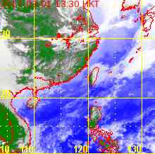
HKO Satellite 香港天文台衛星圖
HKO Track 香港天文台路徑圖
Probabilities
of TC Signals from HKO 香港天文台發出 / 取消熱帶氣旋警告信號的機率
N/A 不適用
Past Bulletins (click on the bulletin no. for the contents) 過往報告
(請按發佈編號顯示內容)
HAGUPIT is the 66th name in the tropical cyclone name list. It was contributed by the Philippines, meaning to lash. This name was used in 2002 and 2008, both necessitating the #8 Gale or Storm Signal in Hong Kong.
HAGUPIT is expected to move WSW along the southeastern periphery of the subtropical ridge anchored in Indochina, in the general direction of southern Vietnam.
黑格比將沿盤據於中南半島的副熱帶高壓脊之東南部向西南偏西移動,大致趨向越南南部。
Intensity
Analysis 強度分析
Current T-number 現時的 T 號碼: T2.5/3.0/W0.5/24 HRS
HAGUPIT's convections weakened again, leaving its circulation centre partially exposed. In a relatively dry environment with low ocean heat content, HAGUPIT is expected to weaken slowly as it traverses South China Sea. Rapid weakening should occur after landfall at Vietnam.
HAGUPIT is now travelling in South China Sea and has intensified slightly. At 2 pm, HAGUPIT was centred about 1080 km (580 NM) ENE of Ho Chi Minh City.
HAGUPIT is the 66th name in the tropical cyclone name list. It was contributed by the Philippines, meaning to lash. This name was used in 2002 and 2008, both necessitating the #8 Gale or Storm Signal in Hong Kong.
The subtropical ridge has now established to the northwest of HAGUPIT. The storm is expected to accelerate to the west turning to WSW, moving towards Vietnam.
副熱帶高壓脊已於黑格比之西北發展,預料黑格比將加速向西轉西南偏西移動,大致趨向越南。
Intensity
Analysis 強度分析
Current T-number 現時的 T 號碼: T3.0/3.0/D0.5/24 HRS
HAGUPIT's core seems to have developed slightly in the past 12 hours. In a relatively dry environment with low ocean heat content, HAGUPIT is still expected to weaken slowly as it traverses South China Sea. Rapid weakening should occur after landfall at Vietnam.
HAGUPIT is the 66th name in the tropical cyclone name list. It was contributed by the Philippines, meaning to lash. This name was used in 2002 and 2008, both necessitating the #8 Gale or Storm Signal in Hong Kong.
As the western subtropical ridge strengthens, HAGUPIT is expected to accelerate to the west turning to WSW, moving towards Vietnam.
隨著西面副熱帶高壓脊增強,預料黑格比將加速向西轉西南偏西移動,大致趨向越南。
Intensity
Analysis 強度分析
Current T-number 現時的 T 號碼: T2.5/3.0/W1.0/24 HRS
HAGUPIT's structure is very disorganized due to prolonged disruption by the terrain of the Philippines. It is expected to maintain marginal tropical storm strength as it enters South China Sea, and continue to weaken as it encounters drier, cooler air.
HAGUPIT weakens into a severe tropical storm as it passes through central Philippines. At 8 am, HAGUPIT was centred about 220 km (120 NM) SE of Manila.
HAGUPIT is the 66th name in the tropical cyclone name list. It was contributed by the Philippines, meaning to lash. This name was used in 2002 and 2008, both necessitating the #8 Gale or Storm Signal in Hong Kong.
HAGUPIT will move WNW turning to W in the next 36 hours. Thereafter the western ridge should exert influence on HAGUPIT and guides it towards the WSW.
黑格比將於未來 36 小時向西北偏西轉西移動,其後西面脊場發揮其影響,帶領黑格比向西南偏西移動。
Intensity
Analysis 強度分析
Current T-number 現時的 T 號碼: N/A 不適用
HAGUPIT is losing deep convections quickly. The storm will continue to weaken while it crosses the Philippines, and also in South China Sea where atmospheric conditions are suboptimal.
黑格比正快速失去深層對流,預料風暴會於橫過菲律賓時繼續減弱。南海大氣情況較差,預料減弱趨勢將持續。
Effects on
Hong Kong 對香港的影響
No threat to Hong Kong is expected within the next 72 hours.
預料黑格比於未來的 72 小時將不會對香港構成影響。
Next Update
下次更新
2014/12/09 (Tue 二), afternoon 下午 (or earlier 或更早)
Other Images
其他圖像
JTWC Track 聯合颱風警報中心路徑圖
JMA Track 日本氣象廳路徑圖
HKO Satellite 香港天文台衛星圖
HKO Track 香港天文台路徑圖
Probabilities
of TC Signals from HKO 香港天文台發出 / 取消熱帶氣旋警告信號的機率
HAGUPIT is the 66th name in the tropical cyclone name list. It was contributed by the Philippines, meaning to lash. This name was used in 2002 and 2008, both necessitating the #8 Gale or Storm Signal in Hong Kong.
HAGUPIT is expected to move WNW along the southwestern periphery of the subtropical ridge as it tracks across the Philippines in the next 48 hours. As HAGUPIT enters South China Sea, the western ridge should take over and steer the storm towards the W to WSW.
HAGUPIT's core is becoming looser and the storm is expected to weaken into a marginal typhoon in the next two days. The storm will be affected by suboptimal environment from the northeast monsoon when it moves across South China Sea, and will continue to weaken.
HAGUPIT is the 66th name in the tropical cyclone name list. It was contributed by the Philippines, meaning to lash. This name was used in 2002 and 2008, both necessitating the #8 Gale or Storm Signal in Hong Kong.
HAGUPIT is situated within a pressure col and will continue to move slowly westward along a weak easterly stream. The subtropical ridge should build back near t+72, providing a slight poleward component to HAGUPIT's track before guiding the storm towards the west within the South China Sea. Land interaction may result in erratic movement as the cyclone crosses the Philippines.
HAGUPIT's eye cleared briefly yesterday, but becomes cloud-filled again today. The storm will lose much strength as it spends long periods of time crossing the Philippines, and is expected to leave the country as a minimal typhoon.
HAGUPIT weakened into category 4 as it moves into the Philippine Sea and decelerates. At 8 am, HAGUPIT was centred about 1010 km (540 NM) ESE of Manila.
HAGUPIT is the 66th name in the tropical cyclone name list. It was contributed by the Philippines, meaning to lash. This name was used in 2002 and 2008, both necessitating the #8 Gale or Storm Signal in Hong Kong.
The subtropical ridge has weakened and HAGUPIT has decelerated significantly. HAGUPIT is expected to remain slow-moving towards the west in the next 72 hours, after which the ridge should build back and push the system into the South China Sea. Land interaction may result in erratic movement as the cyclone crosses the Philippines.
HAGUPIT's eye became cloud-filled last night, and the central dense overcast has warmed. Increase in vertical wind shear and land interaction will cause HAGUPIT to weaken in the majority of the forecast period.
HAGUPIT is the 66th name in the tropical cyclone name list. It was contributed by the Philippines, meaning to lash. This name was used in 2002 and 2008, both necessitating the #8 Gale or Storm Signal in Hong Kong.
HAGUPIT will continue to move WNW along the southern periphery of the subtropical ridge in the next 24 hours. The ridge is forecast to weaken at that time, causing the storm to decelerate. HAGUPIT will remain slow-moving until the end of the forecast period, after which the ridge is expected to build back. The weakness of the ridge is not expected to be deep enough to induce a recurvature, but there is substantial uncertainty to this.
HAGUPIT intensified rapidly over the past 24 hours as its central dense overcast deepened and a well-defined eye emerged. Further intensification is expected in the next 24 hours, after which the storm should weaken as it nears land and atmospheric conditions may not be as favourable.
HAGUPIT is the 66th name in the tropical cyclone name list. It was contributed by the Philippines, meaning to lash. This name was used in 2002 and 2008, both necessitating the #8 Gale or Storm Signal in Hong Kong.
HAGUPIT is expected to travel WNW along the southern periphery of the subtropical ridge in the next 48 hours. The ridge is forecast to weaken at that time, causing the storm to decelerate. A surge of northeast monsoon may induce unfavourable environment that will result in HAGUPIT's weakening. As the storm weakens, it will be subject to lower level steering and move west or even WSW. There is substantial uncertainty to this solution due to the complex atmospheric conditions that are expected to emerge at that time.
HAGUPIT is developing a central dense overcast. In warm seas with low vertical wind shear, the storm is expected to intensify within the next 48 hours. Conditions may deteriorate later on as shear heightens and as the storm nears the Philippines, which should contribute to some weakening.
HAGUPIT is the 66th name in the tropical cyclone name list. It was contributed by the Philippines, meaning to lash. This name was used in 2002 and 2008, both necessitating the #8 Gale or Storm Signal in Hong Kong.
HAGUPIT is expected to travel WNW along the southern periphery of the subtropical ridge in the next 72 hours. The ridge is forecast to weaken at that time, causing the storm to decelerate. A surge of northeast monsoon may induce unfavourable environment that will result in HAGUPIT's weakening. As the storm weakens, it will be subject to lower level steering and move west or even WSW. There is substantial uncertainty to this solution due to the complex atmospheric conditions that are expected to emerge towards the later part of the forecast period.
HAGUPIT has consolidated over the past 24 hours. In warm seas with low vertical wind shear, the storm is expected to intensify steadily within the next 72 to 96 hours. Conditions may deteriorate later on as shear heightens, which should contribute to some weakening.
Tropical disturbance 95W over the western Pacific has gradually intensified into tropical storm 22W, and was named HAGUPIT. At 2 pm, HAGUPIT was centred about 230 km (130 NM) S of Chuuk.
HAGUPIT is the 66th name in the tropical cyclone name list. It was contributed by the Philippines, meaning to lash. This name was used in 2002 and 2008, both necessitating the #8 Gale or Storm Signal in Hong Kong.
HAGUPIT is expected to travel WNW along the southern periphery of the subtropical ridge. The ridge is forecast to weaken by t+72, causing HAGUPIT to decelerate.
黑格比將沿副熱帶高壓脊南沿向西北偏西移動。預料該脊將於 72 小時後減弱,屆時黑格比移速將減慢。
Intensity
Analysis 強度分析
Current T-number 現時的 T 號碼: T2.5/2.5/INT OBS
HAGUPIT is developing quickly and its convections are already wrapping tightly around the centre. In warm seas with low vertical wind shear, HAGUPIT is expected to intensify steadily through t+72 to t+96. Conditions may deteriorate later on as drier air intrudes, which should contribute to some weakening.
 Active Tropical Cyclone(s) 正活躍之熱帶氣旋