
TC Watch / 熱帶氣旋 > Latest TC Info 最新熱帶氣旋資訊 [Refresh 更新]
| Quick links 快速連結: | Current Storm Info 實時氣旋資料 | Past Storm Info 過去氣旋資料 |
| • HKO Storm Info 天文台之熱帶氣旋資訊 | • TC Archive 熱帶氣旋資料庫 | |
| • Official TC Track Info 官方熱帶氣旋路徑資料 | • Selected TC Review 重要熱帶氣旋回顧 | |
| • Tracks from Non-Governmental Agencies 民辦網站預測路徑圖 | • TC Finder 熱帶氣旋尋找工具 | |
| • Latest Numerical Model Outputs 最新數值模式預報: [Tropical Tidbits] [Typhoon2000.ph] [WMOHK 黃家香港氣象局] |
• Wind Speed Data for TCs that Have Affected Hong Kong 影響香港氣旋之風速數據 |
 Active Tropical Cyclone(s) 正活躍之熱帶氣旋 Active Tropical Cyclone(s) 正活躍之熱帶氣旋 |
|
Current
TC Map 即時氣旋資訊 |
| Tropical Cyclone Report 熱帶氣旋報告 |
1. Tropical Depression GAEMI :: 熱帶低氣壓 格美
| Basic System Profile :: 系統基本資料 | ||||||||||||||||||||||||||||||||
| ||||||||||||||||||||||||||||||||
| Tropical Cyclone Classification Scale :: 熱帶氣旋分級 | ||||||||||||||||||||||||||||||||
| Satellite and Analysis Images :: 衛星雲圖及分析圖 | ||||||||||||||||||||||||||||||||
| ||||||||||||||||||||||||||||||||
| HKWW Forecast Track and Intensities :: 本站預測路徑及強度 | ||||||||||||||||||||||||||||||||

| ||||||||||||||||||||||||||||||||
| System Description and Analysis :: 系統描述和分析 | ||||||||||||||||||||||||||||||||
|
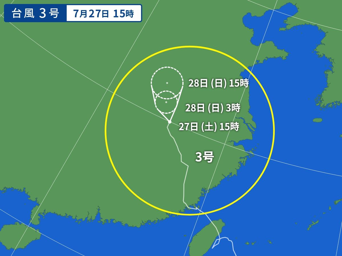
System Overview :: 系統總覽 GAEMI is making its way into Hubei and has weakened into a tropical depression. At 2 pm, GAEMI was centred about 130 kilometres (70 nautical miles) east-southeast of Wuhan. 格美深入湖北,並減弱為熱帶低氣壓。在下午 2 時,格美集結於武漢之東南偏東約 130 公里 (70 海里)。 Tropical Cyclone Naming :: 氣旋命名 GAEMI is the eleventh name in the tropical cyclone name list. It was contributed by South Korea, meaning ant. This name was used four times previously. 格美為熱帶氣旋名稱列表中第 11 個名字,由南韓提供,意思為螞蟻。此前該名曾被使用四次。 Track Analysis :: 路徑分析 GAEMI is expected to move northwest to north-northwest in the next 24 hours and cross Hubei province. 預料格美將於未來 24 小時向西北至西北偏北移動,橫過湖北省。 Intensity Analysis :: 強度分析 GAEMI's convections are getting thinner and its low-level circulation centre is becoming more difficult to locate. The storm will continue to weaken on land, and likely into an area of low pressure in the next 24 to 36 hours. 格美的對流逐漸轉薄,其低層環流中心開始變得較難辨認。風暴將繼續於內陸減弱,預料於 24 至 36 小時後減弱為低壓區。 Effects on Hong Kong :: 對香港的影響 No threat to Hong Kong is expected within the next 72 hours. 預料此系統於未來的 72 小時將不會對香港構成影響。 Next Update Expected :: 預計下次更新 This is the final bulletin for GAEMI. 這是本站對格美的最後一次發佈。 | ||||||||||||||||||||||||||||||||
| Forecast Tracks Issued by Official Agencies :: 官方氣象台預測路徑 | ||||||||||||||||||||||||||||||||
| ||||||||||||||||||||||||||||||||
| Statistical Model-Based TC Signal Probabilities :: 基於統計模型之熱帶氣旋警告信號機率 | ||||||||||||||||||||||||||||||||
| N/A 不適用 | ||||||||||||||||||||||||||||||||


| Past Bulletins (click on the bulletin no. for the contents) 過往報告 (請按發佈編號顯示內容) |
Last Accessed 最近訪問日期: Sat Jul 27 2024 18:05:31 HKT
Last Modified 最近修訂日期: Mon Jul 24 2023
